Perhaps forests aren’t the first thing you think of when discussing California; it might instead be the coast with its fantastic beaches. However, there are many stunning sights, attractions and views to be discovered with the National Forests in America. California alone has millions of acres of designated protected forest. We look at 10 of the largest National Forests that can be found in California.
If camping in any of the forests, be aware of restrictions that may be in place on building fires as forest fires are a risk to these sites. You should also make sure you stay on any marked paths and do not deter from those that are already in place. Try to have as little an impact on the area as possible to preserve it for those to come. Be sure to book your California car hire so you can get to these sites as easily as possible, and so you’ll have unhindered access to the scenic byways described below.
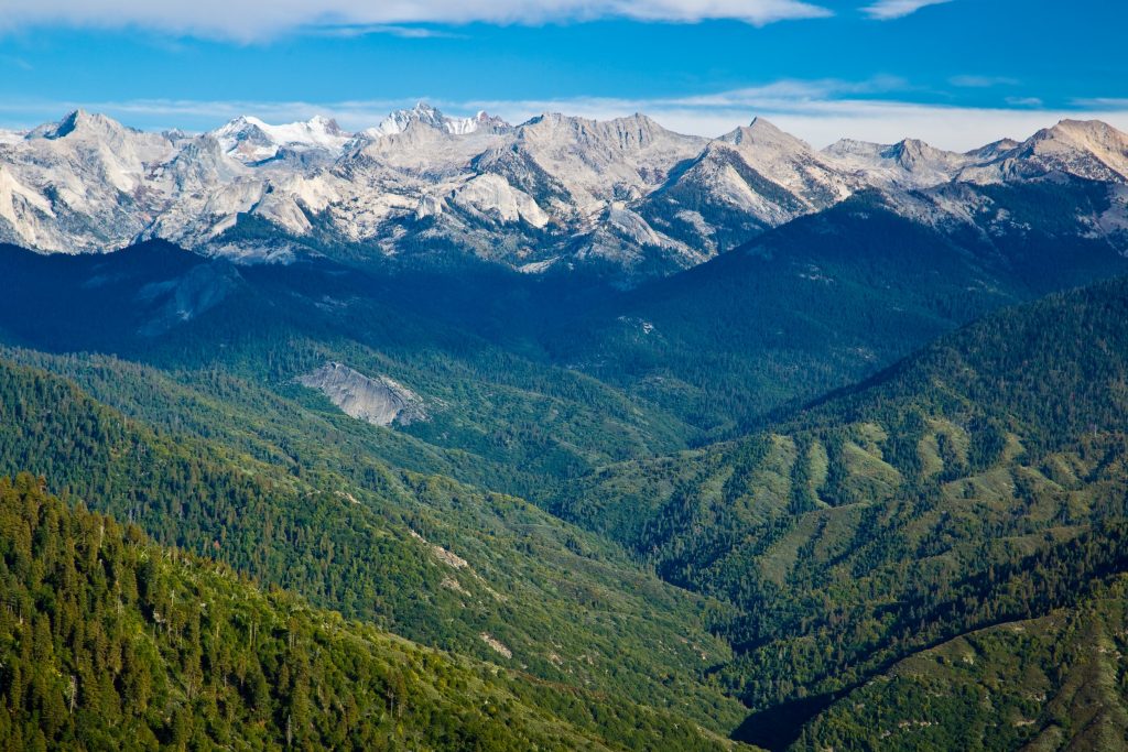 Views from Moro Rock in Sequoia National Park, part of Sierra National Forest, California. Photo by: Anatolly Lukich/Stock
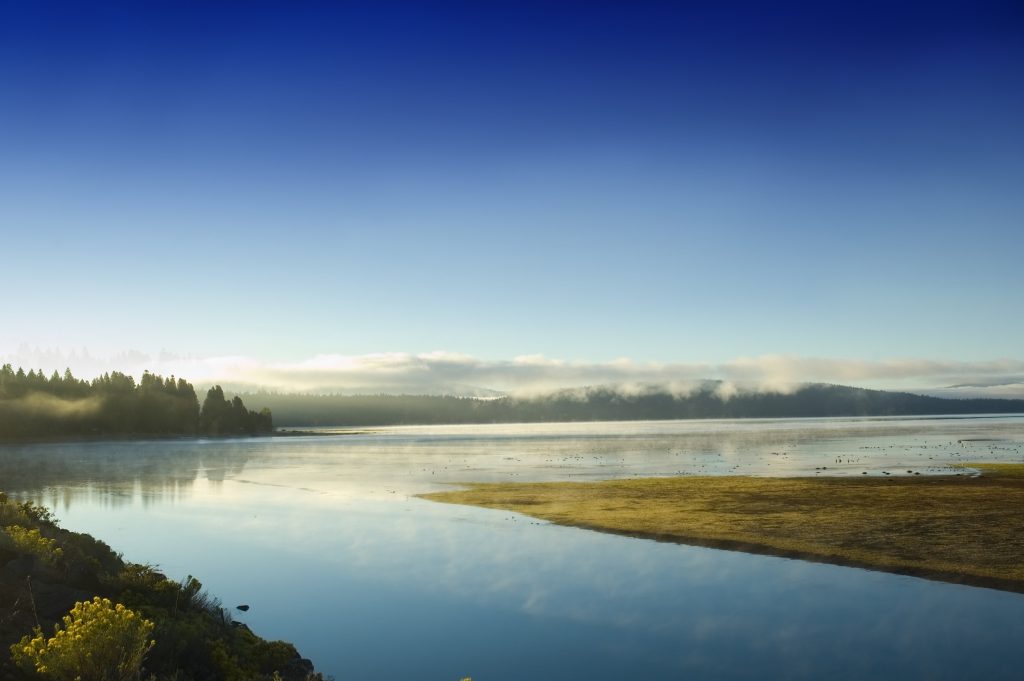
Sierra National Forest
Crossing the states of both California and Nevada, this National Forest covers 2,000 square miles and became the second National Forest in California to be named. It incorporates Yosemite and Sequoia National Parks as well as the west slope of Mount Whitney, the tallest peak in California at 14,505 ft.
Hiking opportunities come in the form of the sections of the John Muir Trail and the Pacific Crest National Scenic Trail that run through the Forest. There are many granite formations to be spotted, including the Fresno Dome which rises out of Soquel Meadow.
What’s the Pacific Crest National Scenic Trail? This is a scenic route of 2600 miles between Canada and Mexico.
Walk amongst Giant Sequoia trees, particularly at Nelder Grove, a 1540 acre area where over 100 mature Giant Sequoia are located. Here you can see Bull Buck Tree, standing 75 metres high with a ground-level circumference of 30 metres. Nelder Tree, the largest tree in Nelder Grove is the 22nd largest Giant Sequoia in the world with a cubic volume of 990m3. The poignant Graveyard of the Giants is a landmark of sequoias that were killed by wildfire.
Fishing is a popular activity here, with the reservoirs such as Bass Lake, Wishon Reservoir and Courtright Reservoir, drawing anglers. There are also opportunities for other water sports, such as boating, canoeing, water skiing, windsurfing and white water-rafting. In the winter, you can participate in the likes of Nordic skiing, sledding, and snowmobiling.
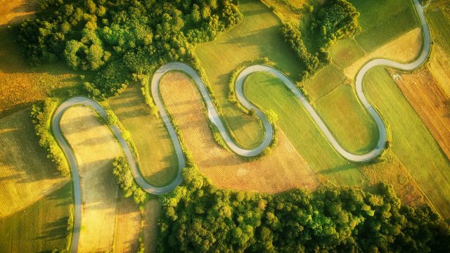
There are two beautiful drives you can take in the area. The Sierra Vista Scenic Byway, covering nearly 100 miles, starts near North Fork and twists its way up to over 7000 feet into the Sierra Nevada Mountains. Alternatively, there’s the Sierra Heritage Scenic Byway which is about 70 miles long, connecting Clovis to Kaiser Peak at 10,320 ft, via Shaver Lake and Huntingdon Lake.
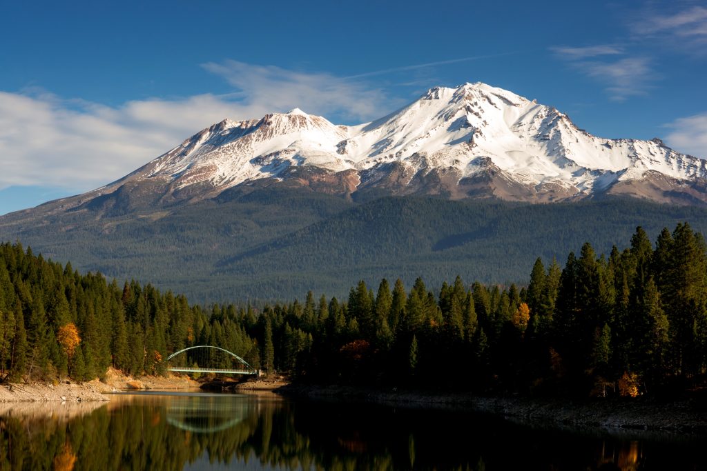 Mount Shasta rising over Shasta Lake, in the Shasta-Trinity National Forest, California. Photo by: Anatolly Lukich/Stock
Shasta-Trinity National Forest
The largest National Forest in California covers 5 designated Wilderness Areas, 894,552 hectares, 1000km of rivers and streams, and hundreds of mountain lakes, including Shasta Lake, the largest man-made lake in California. Created as a result of the Shasta Dam, the 9th tallest dam in the US, the lake attracts houseboats along the various marinas as well as those seeking a thrill from water sports.
What’s a Wilderness Area? These are specially designated areas where human impact has been minimal and so the land has very much retained its natural state.
Locate Mount Shasta, a potentially active volcano which is at the southern end of the Cascade Range. Standing at 14,1789ft, it’s the second tallest peak in the Cascades and the 5th highest in California. To discover more of California’s volcanoes, consider taking the Volcanic Legacy Scenic Byway. This is a 500-mile tour that incorporates views of northern California’s volcanoes, and also enters Oregon for Crater Lake.
There are over 460 miles of hiking trails, including a 154-mile stretch of the Pacific Crest Trail. If you’d prefer the comfort of 4 wheels, consider driving the Trinity Heritage Scenic Byway or Trinity River Scenic Byway. The first takes you from 2000ft to 6500ft following the footsteps of early miners and settlers from Weaverville to Weed. You can pick up a free brochure and guide from the ranger station in Weaverville. The latter route follows Highway 299 through diverse scenery with opportunities to spot a variety of flora and fauna. Starting in Shasta, the road runs through Sacramento River Valley and the Redwood Coast, before ending at Blue Lake near the city of Arcata. The route takes around a minimum of 4 hours to cover 140 miles, but be sure to allocate more time if you plan on making lots of stops.
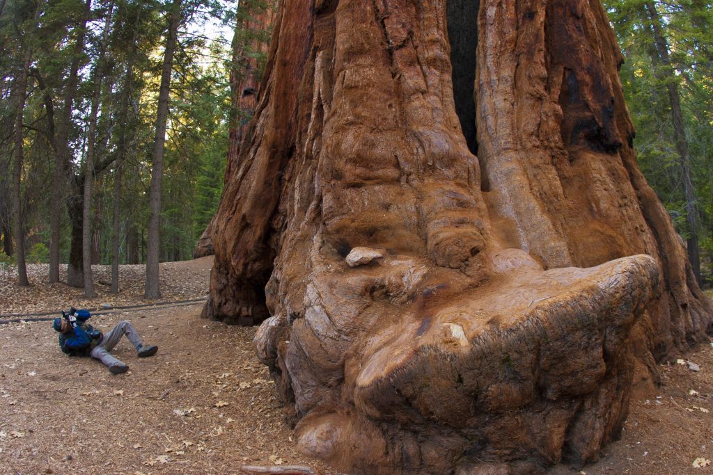 Giant Sequoia trees have a huge base. Found in the Sequoia National Forest, California. Photo by: Oleg Kovtun/Stock
Sequoia National Forest
As the name suggests, it’s the Giant Sequoias located here that the area is famed for. Situated in the southern region of the Sierra Nevada mountains, there are 38 groves in the Forest populated by Giant Sequoias. Of these, the Giant Sequoia National Monument covers about half of the groves in existence and 328,000 acres of land. Of the ten largest Sequoias in the world, one is located within the National Monument, the Boole Tree, which stands at a majestic 269ft high.
The landscape has been carved by previous glaciers, leaving behind differing formations. The Needles are located above the Kern River and are an appropriately-named group of granite spires that tower into the sky above. These are popular for rock climbing and offer some breath-taking views of the surrounding area.
The rest of the Sequoia National Forest can be explored via over 2500 miles of roads and 850 miles of hiking trails. 78 miles of the Pacific Crest National Scenic Trail runs through this National Forest. There are lots of recreational activities to indulge in, such as horseback riding, kayaking, mountain biking, and white-water rafting.
Rogue River-Siskiyou National Forest
This National Forest used to be two separate entities, but they were combined in 2004. Crossing into Oregon, the forest extends from the crest of the Cascade Mountains to the Siskiyou Mountains, a whopping total of almost 1.8 million acres. However, only a portion of this lies in California; the part of what was the Rogue River National Forest is in Siskiyou County (53,800 acres), whereas the Siskiyou National Forest portion is in Del Norte County (38,000 acres). There are over 200 miles of rivers which lend themselves to great fisheries, plus diverse flora and fauna.
Mount Emily, part of the Rogue River-Siskiyou National Forest in Oregon, is known in the history books for being the first area in the continental US to be hit by enemy aircraft bombs in World War II.
 Lake Almanor, Plumas National Forest, California. Photo by: Jeffrey Banke/Stock
Plumas National Forest
Situated in Sierra Nevada, this National Forest is just south of the Cascade Range, with around 85% of the area falling in Plumas County.
The Feather River Scenic Byway runs through the only pass that remains open year-round in the Sierra Nevada range. This 130-mile route starting outside Oroville winds alongside the North Fork of the Feather River. Taking a cliff-top path, you’re guaranteed some incredible views. If visiting Oroville, pop along to the Visitor Centre at Lake Oroville State Recreation Area for an insight into the natural and cultural history of the area. To get a better vantage point of your surroundings, climb the 47ft observation tower. At the top, you’ll be able to use the telescopes available to see the smallest mountain range in the world, the Sutter Buttes, located just outside Yuba City. By taking the Feather River Scenic Byway, you’ll drive through three tunnels that have been carved into the mountains. Information boards are peppered throughout the trail, detailing the gold mining history of the area. Keen eyes might be able to spot wildlife such as the bald eagle or Black tail Colombian deer, among others.
Other highlights include Lake Almanor, the largest lake in Plumas County, and the Western Pacific Railroad Museum in Portola, where you have the chance to drive a diesel locomotive.
Modoc National Forest
Entering the counties of Modoc, Lassen and Siskiyou, this National Forest in north eastern California was formed from land once covered by a lava flow millions of years ago. Climb and explore among the Warner Mountains. Forests are formed from a variation of trees such as ponderosa pine, red and white firs, lodgepole, and west white pines.
 Big Sur Coast Falls within the Los Padres National Forest, California. Photo by: Melastmohican/Stock
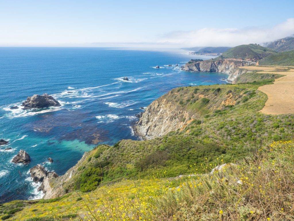
Los Padres National Forest
Incorporating most of the mountainous land between Ventura to Monterey along the coast of California, the elevations range from sea level to 8847ft. In total, there are 323 miles of hiking trails to explore. Lots of mileage here to enable you to spot the threatened and endangered species that populate the area, such as the California condor, California kingsnake, and American peregrine falcon. There are two condor sanctuaries, both of which are closed to the public; Sisquoc Condor Sanctuary and Sespe Condor Sanctuary. More common throughout the area include mountain lions and California mule deer. There are 400 miles of both year-round and seasonal streams, along with 37 different lakes and reservoirs for fishing.
It’s possible to find pictographs dotted on rock outcroppings and caves around the forest, left there by Chumash Indians.
What are pictographs? Pictographs are the earliest known form of writing, where symbols and images were drawn to represent meanings and phrases.
The northern area of the forest falls within Monterey Coast, and includes the Big Sur Coast. Also worth including on your itinerary are the Santa Lucia Mountains and the La Panza Range. The highest peaks in the region are Mount Pinos, Cerro Noroeste and Reye Peak; great for mountaineers to tick off their climbing list.
Take Highway 33, a 38-mile segment of which is called the Maricopa Highway, which forms the Jacinto Reyes Scenic Byway.
Klamath National Forest
Formed by trees such as ponderosa pine, Jeffrey pine and Douglas fir, this forest in Northern California is in Siskiyou county, but 1.5% spills over into Oregon. Elevations range from 900ft to 9000ft above sea level.
Here, you’ll find Kangaroo Lake and 200 miles of rivers for rafting, as well as 152 miles of wild and scenic rivers to discover.
 Bristlecone Pine Forest within with Inyo National Forest, California. Photo by: Krzysztof Wiktor/Stock
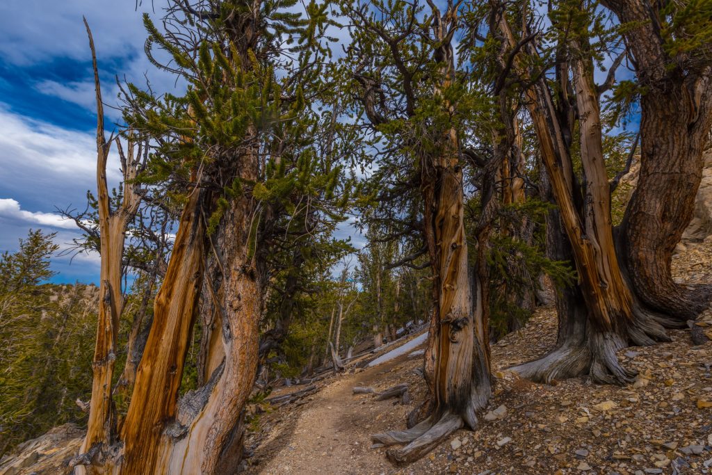
Inyo National Forest
Covering parts of eastern Sierra Nevada and the White Mountains, the total acreage is 1,903,381, with 60,700 of this in western Nevada. The name is derived from the Native American word ‘Inyo’, which means ‘dwelling place of the great spirit’. The forest runs from eastern Yosemite to the south of the Sequoia National Park. The east slope of Mount Whitney falls under Inyo National Forest protection.
Explore the Ancient Bristlecone Pine Forest, established to protect growths of Great Basin bristlecone pines. Here, you’ll meet Methuselah; the second oldest known non-clonal living tree. It’s said to be older than 4839 years.
This National Forest has been used as filming locations for several films, including ‘Ride the High Country’ (1962), ‘Nevada Smith’ (1966), and ‘Star Trek: Insurrection’ (1998).
 Winnemucca Lake from the Pacific Crest Trail, California. Photo by: Alexrc/Stock
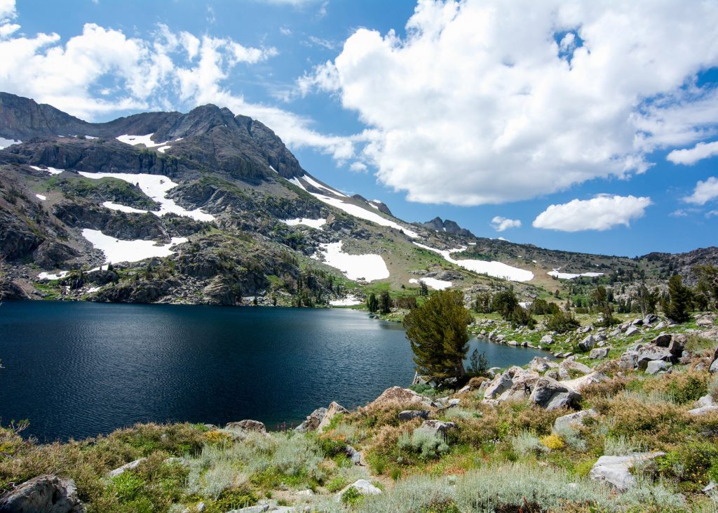
Humboldt-Toiyabe National Forest
In total, this is the largest National Forest in America outside of Canada. However, the largest portion of it lies in Nevada, with a small piece in eastern California. It covers a whopping 6.3 million acres and includes 18 Wilderness Areas.
Hike through the deep canyons of the Quinn Canyon Wilderness and see how the peaks over 10ft high have been formed with red volcanic rhyolite at the bottom and grey limestone at the top.
The Pacific Crest National Scenic Trail runs through the Mokelumne Wilderness.
Be sure to look out for the thousands of prehistoric and historic archaeological sites that are littered throughout the area. It’s said there are more than 80,000.
Your trip to the National Forests of California
Have you visited the National Forests listed above? What highlights would you recommend that other travellers add to their itineraries?
If you’re planning a trip there, what are you most looking forward to seeing or doing?
Let us know in the comments below.
Written by Jessica Juby.
Make sure you follow us on Twitter and Facebook for the latest travel tips and news. Remember to sign up to our newsletter below for the latest deals.
Subscribe to our newsletter
Want our blogs emailed direct to you? Sign up below to get updates featuring our blogs and car hire top tips. Receive the best deals on car hire straight to your inbox.